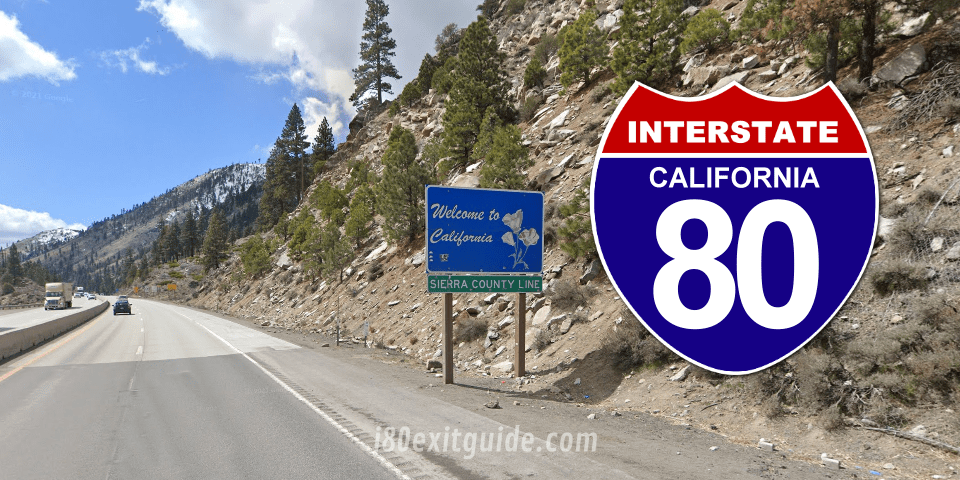
California I-80 Fast Facts
Total California I-80 Miles: 204 miles
Total California I-80 Driving Time: 3 Hours, 10 Minutes
Major Cities Along the Way: San Francisco, Oakland, Sacramento
Navigating Interstate 80 Through California
Route Overview
While I-80 begins it’s eastward journey in San Francisco, once you enter Vallejo, the landscape immediately shifts from suburban sprawl to expansive marshlands and salt flats of the Suisun Bay. This stretch spans approximately 30 miles before you reach Fairfield and Vacaville, familiar pit stops for travelers seeking fuel or a quick meal. Pay attention to the traffic patterns here, as morning and evening rush hours can turn this segment into a slow crawl, sometimes extending your travel time by up to 45 minutes. Variable speed limits along this corridor adapt to weather and congestion, so staying alert to electronic signs will keep your journey smooth.
Continuing past Vacaville, the highway ascends toward the rolling hills of the Sacramento Valley. Your drive will cover nearly 80 miles before you reach the outskirts of the state capital. Along this stretch, you’ll cross the Yolo Causeway—an impressive 3.2-mile elevated section over the wetlands. Its open design creates a distinctive driving experience but can also result in strong crosswinds, especially in the afternoon. This is a great spot to stretch your legs at nearby Turnouts or to snap some photos of the vast delta scenery before urban life intensifies as you approach Sacramento.
California I-80The Road Ahead: Key Features of I-80
Stretching approximately 204 miles within California, I-80 offers a diverse blend of urban landscapes, mountain passes, and rural scenery that keeps every mile compelling. You’ll navigate through the San Francisco Bay Area’s bustling corridors before transitioning into the less congested, more panoramic terrain of the Sierra Nevada. The total driving time covers around 3 to 4 hours without major stops, but the route’s varied features prompt many drivers to allow extra time for exploration and breaks.
The highway itself includes segments designed to accommodate heavy truck traffic and tourist vehicles alike, with multiple lanes and periodic safety enhancements. Expect a mix of modern interchanges and older sections that highlight the highway’s historical evolution. Keep an eye out for some of these notable elements:
- Major urban centers: San Francisco, Oakland, Sacramento
- Scale of mountain passes: Donner Summit at 7,239 feet elevation
- Key river crossings: American River, Feather River
- Rest areas and visitor centers: multiple ideal for stretching and information
- High traffic zones and commuter patterns near Bay Area exits
- Frequent snow chain requirements and roadside weather alerts in winter months
- Scenic overlooks providing sweeping views of the Sierra Nevada foothills
- Historic landmarks including old railroad tunnels and pioneer monuments
- Proximity to state parks and recreational areas such as Folsom Lake and Auburn State Recreation Area
Scenic Vistas and Landmarks
Driving along I-80, your view alternates between city skylines and remarkable natural beauty, especially as you skirt the Sierra Nevada mountains. At Donner Summit, for instance, the historic significance and breathtaking landscape merge, presenting panoramic vistas of rugged peaks and glistening reservoirs. Approaching this high elevation, you’ll notice the preservation of pioneer history through plaques and monuments that narrate the trials of the westward expansion.
Further along, the American River Parkway near Sacramento offers verdant scenes contrasting with the surrounding urban areas. The highway’s design incorporates several viewpoints that provide a momentary retreat from driving with gorgeous river valley perspectives. These vantage points are perfect for photo stops or a quick breather to soak in the interplay of California’s natural and human-made environments.
Unique Attractions and Stops
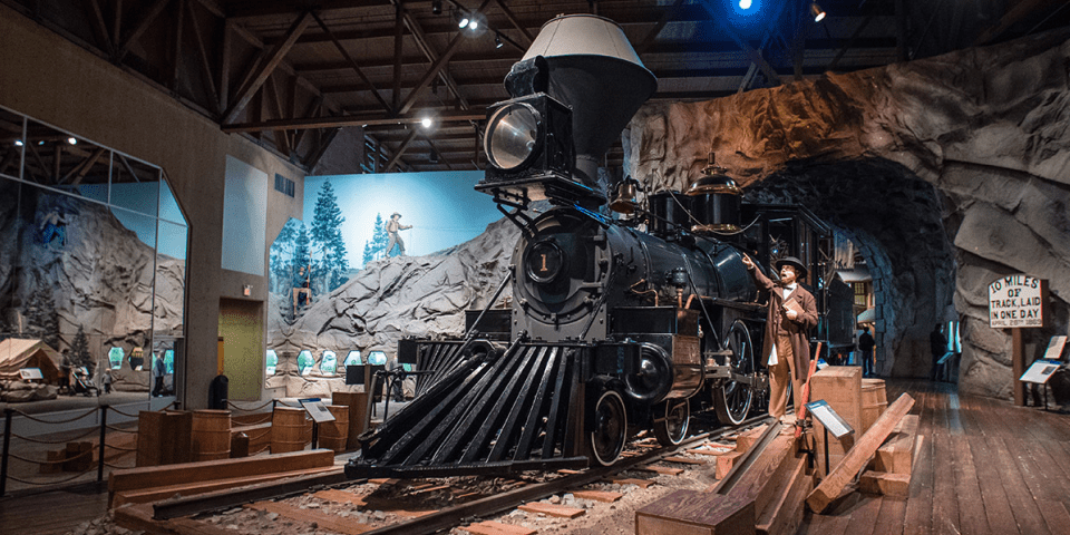
Interspersed along I-80 are numerous unique attractions that invite you to pause your journey and probe deeper into local culture and history. In Sacramento, you can explore the state capital’s array of museums and historic sites like the Old Sacramento Waterfront, which preserves the charm of a 19th-century river town. Further east, Truckee offers not only an inviting mountain town atmosphere but also access to museums and art galleries showcasing the region’s logging and railroad heritage.
Besides these cultural highlights, you’ll find culinary gems and local markets ideal for tasting northern California flavors—artisan cheeses, fresh produce, and iconic wine offerings reflect the area’s agricultural richness. Quaint roadside diners and modern eateries alike provide a spectrum of culinary experiences, often complemented by spectacular views or historical ambiance.
Moreover, the highway runs close to several natural parks and recreational areas, including the Auburn State Recreation Area and Folsom Lake, inviting you to incorporate outdoor activities into your road trip. Whether you prefer hiking, fishing, or simply enjoying a picnic with a view, these stops contribute to a richly layered travel experience along I-80.
Urban Hubs: Major Cities Along the Route
As you continue driving east on I-80 through California, several key urban centers punctuate your journey, each offering distinct cultural experiences and crucial amenities. These cities not only serve as waypoints for rest and refueling but also provide rich opportunities to explore historic sites, vibrant neighborhoods, and bustling business districts. The traffic density tends to increase as you approach these hubs, so allow extra time during peak hours to navigate city approaches smoothly.
The diversity of environments you’ll encounter reflects California’s varied geography and population centers—ranging from the iconic bay area to the state’s political heart and beyond into the Sierra Nevada foothills. Each city along I-80 marks a unique chapter in your road trip, revealing different facets of California’s dynamic urban landscape.
San Francisco: The Gateway to Adventure
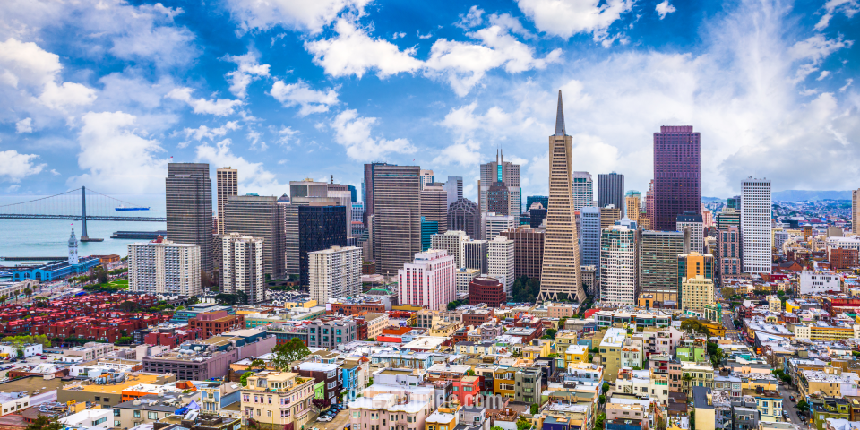
Beginning at the western terminus of I-80 in California, San Francisco stands as a vibrant hub of culture, technology, and history. As you navigate the maze of highways and bridges linking into the city, the iconic Golden Gate Bridge often serves as your first breathtaking sight. Within the city, neighborhoods like the Mission District and SoMa provide a mosaic of culinary delights and arts scenes that beckon exploration.
Parks such as the expansive Golden Gate Park offer refreshing green retreats right in the urban core, and you’ll find the Embarcadero a lively waterfront that’s perfect for a scenic walk or grabbing a bite at a local seafood eatery. If time permits, a quick detour off I-80 toward Fisherman’s Wharf introduces you to the bustling waterfront attractions and the historic ferry terminals, setting the tone for your California adventure.
Sacramento: California’s Capital Experience
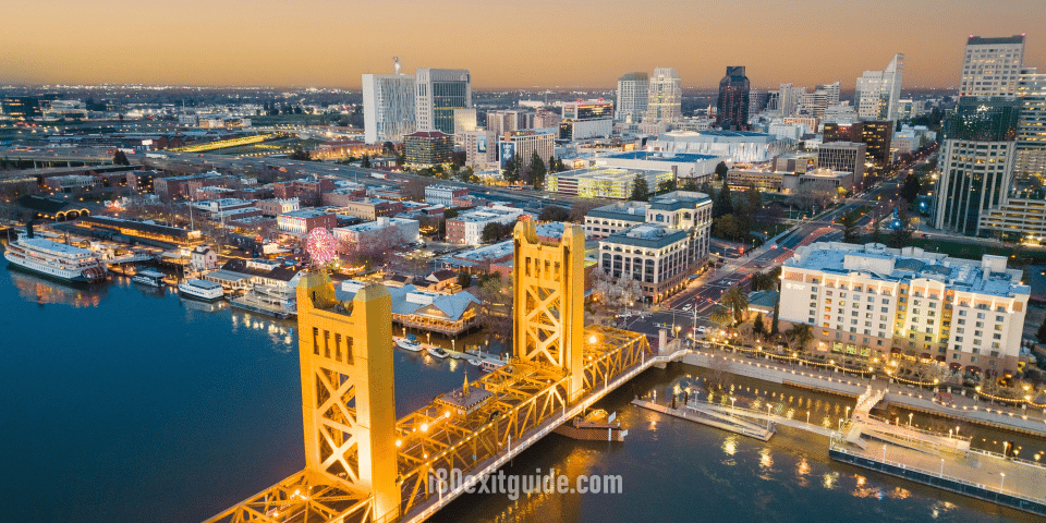
Driving onward, Sacramento emerges as a pivotal stop where I-80 cuts through the heart of California’s governmental and cultural scene. As the state capital, it houses the impressive California State Capitol building, surrounded by lush gardens and historic monuments. You’ll easily access museums such as the California State Railroad Museum, which traces the transformative impact of the transcontinental railroad on the West’s development.
The city’s grid layout simplifies navigation and reveals an eclectic mix of dining options from farm-to-fork restaurants to welcoming local diners. With a population nearing half a million, Sacramento manages to balance a dynamic urban vibe with easy access to outdoor recreational areas along the American River Parkway, perfect for a midday break during your drive.
Additional insights about Sacramento’s role as a key intersection along I-80 include its function as a distribution hub due to its strategic rail and highway connections. Local events such as the annual State Fair add seasonal interest, and you’ll find the city’s expanding craft brewery scene an inviting way to unwind after hours on the road.
Reno: The Biggest Little City in the World
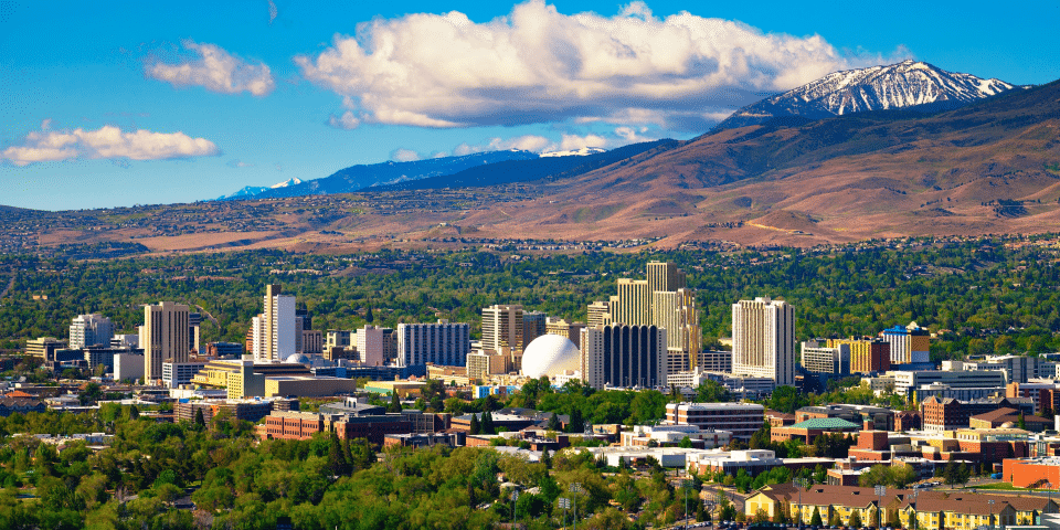
Crossing into Nevada while still technically following I-80, Reno might surprise you with its blend of small-town charm and big-city amenities. Known as “The Biggest Little City in the World,” Reno has cultivated a reputation for lively casinos, vibrant arts festivals, and outdoor adventures just minutes from downtown. The city often serves as a gateway to the Sierra Nevada ski resorts and Lake Tahoe’s stunning alpine scenery.
Traffic here tends to be lighter than California’s urban centers, allowing for smoother passage through the city with easy freeway access to local attractions. You might want to explore Midtown Reno, where indie boutiques, street art, and concert venues offer a peek into the city’s growing creative community, or try your luck at one of the many casinos lining the riverwalk.
Moreover, Reno’s economy has diversified beyond gaming, embracing technology startups and manufacturing, which fosters a progressive atmosphere contrasting with its nostalgic Old West roots. The city’s annual events like the Reno Air Races and Burning Man nearby add layers of unique cultural texture that enhance your journey along I-80.
Practical Know-How: Essential Driving Tips
As you drive I-80 through California, adaptability will be your biggest asset. Traffic can vary dramatically between the urban stretches near Sacramento and more rural segments approaching Nevada. Adjusting your speed to match the flow of traffic without compromising safety helps maintain a smooth ride and prevent accidents. Also, keep an eye on digital signs that communicate lane closures or upcoming delays; these updates allow proactive lane changes and help avoid sudden braking.
California I-80 exit services (food, gas, and lodging) located within 1/2 mile of an I-80 exit are listed here. These listing run east to west. Individual exits show intersecting routes and cities and towns accessible from that exit.
Managing rest stops effectively impacts your overall stamina and focus. The corridor boasts rest areas at roughly 30 to 50-mile intervals, with amenities ranging from picnic facilities to basic services. Planning breaks in advance—especially at popular stops like the Fairfield-Vallejo welcome center—gets you refreshed without adding unnecessary time to your journey. Knowing where these stops fall along your route lets you maintain alertness across the total 150-mile stretch that typically takes around 2.5 to 3 hours under normal traffic.
Navigating Traffic Patterns
You’ll encounter some of the highest traffic volumes near the Bay Area, especially during morning and evening rush hours. Congestion around the Carquinez Bridge often causes slowdowns, so timing your drive to avoid peak commuter windows can save significant delays. The use of express lanes in these regions can be beneficial if you have a valid FasTrak transponder, allowing you to bypass some traffic and maintain consistent speeds.
What’s happening on Interstate 80 RIGHT NOW! I-80 Real-Time Traffic information for cities along I-80. Maps show updates on road construction, traffic accidents, travel delays and the latest traffic speeds. Traffic cameras show congestion at a glance. DOT posts bring the latest incidents and their status. Road News includes related I-80 articles. Data is automatically updated every 5 minutes, 24 hours a day, 7 days a week!
Construction zones, particularly in the vicinity of Vallejo and Sacramento, introduce lane reductions and temporary speed limits. Keeping a safe following distance in these areas is vital because stop-and-go conditions and sudden merges are common. Also, pay attention to the traffic cameras positioned along the route for real-time updates via your GPS or smartphone apps, which can alert you to incidents several miles ahead. Knowing the timing and locations of these traffic patterns helps you anticipate slowdowns and alter your route as necessary.
Safety Measures and Emergency Protocols
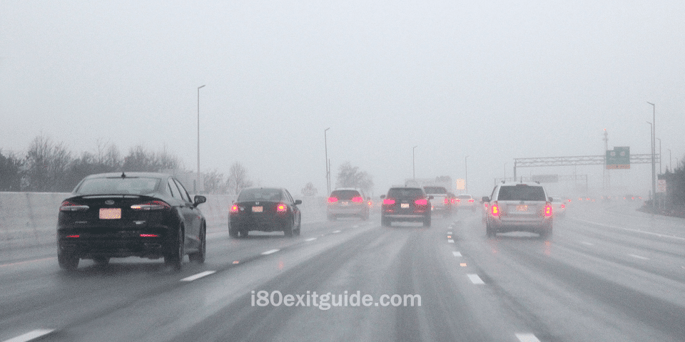
The I-80 corridor in California is equipped with emergency call boxes spaced at intervals of about one mile in critical areas prone to accidents or breakdowns. If you experience vehicle trouble, safely pulling over to the shoulder and using one of these call boxes connects you directly to highway patrol dispatchers, ensuring timely assistance. Additionally, roadside flare kits and reflective triangles are standard recommendations for your vehicle’s emergency kit to improve visibility during unexpected stops, particularly at night or in foggy conditions common in certain segments.
Planning an I-80 road trip and need to know what the next few days will bring? Here are the latest I-80 weather forecasts for selected cities along the route.
Awareness of evacuation routes along I-80 is invaluable in the event of natural disasters like wildfire or flooding, which can affect parts of Northern California. Signage along the highway directs you toward alternate routes, often coordinated with local emergency management to facilitate quick and orderly traffic flow during such incidents.
Local authorities advise carrying enough water, basic first aid supplies, and a portable phone charger when traveling this route to prepare for any extended roadside waits. Knowing the layout of safe pullouts, rest areas, and the location of nearby towns also enhances your ability to handle emergencies efficiently while on the road.
California’s I-80 In a Nutshell
Conclusively, driving I-80 in California offers you a dynamic journey through diverse landscapes, connecting you from the bustling San Francisco Bay Area to the eastern border near Nevada. Spanning approximately 204 miles, this segment of I-80 provides an estimated driving time of around 3 to 4 hours, depending on traffic and weather conditions. Whether you’re commuting, exploring scenic views, or heading toward destinations like Sacramento or Truckee, understanding the route and preparing for varying road conditions will help you navigate this highway effectively.
As you travel along I-80, you’ll experience a mix of urban settings and mountainous terrains, which means your driving approach may need to adjust accordingly. Paying attention to traffic updates and planning for pit stops can enhance your drive, making it safer and more enjoyable. By staying informed about your route, you’ll be better equipped to handle the challenges and appreciate the unique features of this important California corridor.
The I-80 Exit Guide is the Internet’s largest and most complete website dedicated to Interstate 80 travelers. Find detailed exit service listings… lodging, camping, food, gas and more for every exit from New Jersey to California!
On the road? Why not take us with you. The I-80 Exit Guide is mobile-friendly and totally FREE. No App Required.
Traveling another route? Visit our growing family of exit guides: I-4 Exit Guide, I-5 Exit Guide, I-10 Exit Guide, I-75 Exit Guide, I-80 Exit Guide and I-95 Exit Guide. Detailed exit service listings… discount lodging, camping, food, gas and more for every exit along the way!

