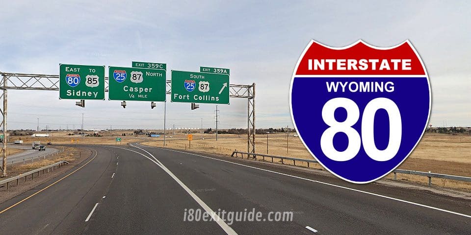
Wyoming I-80 Fast Facts
Total Wyoming I-80 Miles: 402 miles
Total Wyoming I-80 Driving Time: 5 Hours, 18 Minutes
Major Cities Along the Way: Laramie, Cheyenne
Navigating Interstate 80 Through Wyoming
Route Overview
As you launch on I-80 across Wyoming, you’re covering approximately 402 miles from the eastern border at Nebraska to the western edge near Utah. Expect to spend roughly 5 to 6 hours driving without significant stops, although conditions can vary depending on weather and traffic. The route traverses a diverse landscape, from the rolling plains near Cheyenne to the foothills of the Laramie Mountains and the vast expanse of the Red Desert. Each segment brings distinct changes in elevation and terrain, which impact driving dynamics and fuel efficiency.
I-80 WyomingMajor Stops and Services Along the Way
Key cities like Cheyenne, Laramie, and Rock Springs offer valuable opportunities to refuel, recharge, and take breaks. Cheyenne, just over 3 miles inside Wyoming, provides multiple service areas and dining options. As you approach Laramie around mile marker 323, you’ll find a good mix of amenities alongside local charm, making it an ideal spot to stretch your legs. Further west, Rock Springs near mile marker 136 marks the halfway point and features ample fueling stations with close highway access. Planning your stops in these hubs can help maintain your energy and ensure your vehicle stays in optimal condition for Wyoming’s sometimes challenging stretches.
Beyond the Mile Markers: Exploring Key Features
The 402-mile stretch of I-80 in Wyoming not only serves as a vital transportation artery but also offers a remarkable collection of features that enrich your driving experience. As you move east to west or vice versa, several key elements stand out, each adding a layer of interest to the otherwise straightforward highway passage. From mountain passes and wildlife corridors to rest stops equipped with local history displays, this segment has much more than just pavement and signs.
Knowing the location and nature of these features can help you better plan your stops, anticipate scenic views, and engage more deeply with the region you’re traversing. Whether you’re interested in natural beauty or cultural history, the I-80 corridor in Wyoming invites exploration beyond the obvious.
- Elevation changes—from the plains near Pine Bluffs to the ascent over Sherman Summit (8,640 ft)
- Designated wildlife crossing areas and conservation zones
- Rest and service areas with informative local exhibits
- Proximity to the Medicine Bow National Forest and Vedauwoo Recreation Area
- Key junctions linking you to historic towns like Laramie and Rawlins
- Segment featuring Echo Canyon viewpoints offering panoramic vistas
- Historical markers detailing the Oregon Trail and the Transcontinental Railroad
Scenic Landscapes and Natural Wonders
I-80 carves through Wyoming’s diverse topography, offering you continuously shifting vistas. Near the western border, the transition from the High Plains into the Medicine Bow Mountains presents sweeping views of rugged mountain peaks, dense forests, and alpine meadows. The climb over Sherman Summit is both a challenge and a reward, elevating you to the highest point on Interstate 80 across the country, where the panoramic vista captures endless skies and distant ridges.
Further east, the Vedauwoo rock formations are a geological marvel that you can glimpse from designated turnouts. These surreal, wind-sculpted granite outcrops are a popular spot for climbers and photographers alike. The long stretches through open plains showcase Wyoming’s trademark big sky, dotted occasionally by herds of pronghorn or mule deer crossing alongside the highway. The variety in landscapes ensures your focus shifts from driving mechanics to appreciation of natural artistry.
Historical Landmarks and Cultural Insights
Your journey along I-80 places you near significant historical sites that illuminate the narratives of early American West expansion and indigenous heritage. The Oregon Trail, closely paralleling portions of I-80, is marked at multiple points, including a notable visitor center near Laramie, where you can explore pioneer artifacts and trail history. Alongside this, the railroad’s legacy—particularly the Union Pacific’s role in completing the Transcontinental Railroad—is commemorated through interpretive signage and small museums.
Ranching culture also pervades much of the terrain you cross. The roadside exhibits and local historical markers shed light on how cattle and sheep ranching shaped Wyoming’s economy and lifestyle through the 19th and 20th centuries. Small towns like Rawlins preserve mining and railroad heritage, offering a glimpse into the labor and daily lives that built the modern state.
Delving deeper, Wyoming’s Native American history is reflected in several sites accessible from I-80, including tribal lands and interpretive exhibits that share stories of the Arapaho, Shoshone, and other peoples. Attending local cultural centers or scheduled events along the route can give you a richer understanding of the diverse roots embedded in Wyoming’s landscape.
Community Hubs: Major Cities Along I-80
As you navigate I-80, several key urban centers stand out for their unique contributions to Wyoming’s identity. These cities serve not just as stops for refueling and rest, but as vibrant community hubs that reflect the state’s rich heritage and evolving culture. Each offers distinct experiences, from the collegiate atmosphere of Laramie to Cheyenne‘s blend of government and Old West charm, followed by Rawlins, which opens the door to Wyoming’s outdoor adventures.
Beyond their practical roles as landmarks along the highway, these cities offer you opportunities to probe into local history, cuisine, and landscapes. Strolling through downtowns or visiting regional museums, you’ll find deeper connections to the narratives that have shaped Wyoming. Planning your trip with these stops in mind adds layers of discovery beyond the open road.
Laramie: The College Town with a History
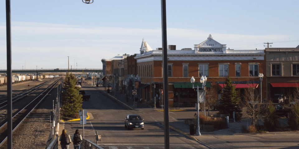
As you pull into Laramie, the home of the University of Wyoming, the town’s youthful energy is immediately apparent. Founded in the late 19th century, Laramie blends historic charm with a progressive vibe thanks to its status as an educational hub. The university campus itself features notable attractions like the American Heritage Center, where you can explore archives and exhibits detailing life in the American West. Laramie’s brick-lined downtown invites you to browse independent bookstores, cafes, and galleries that spotlight local artists.
Not far from the university, the impressive Wyoming Territorial Prison offers a journey into the past with original cells and guided tours that recount tales of outlaws and early settlers. As you explore, this city showcases an intriguing balance: respect for its rugged roots alongside a commitment to fostering innovation and culture — a duality that enriches your drive across the state.
Cheyenne: The Capital with Frontier Spirit
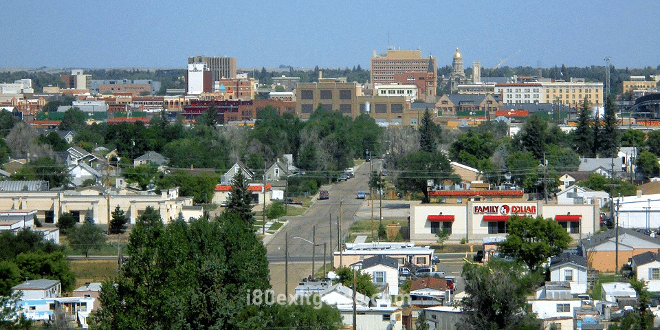
Cheyenne, as Wyoming’s capital, puts a spotlight on Western heritage fused with governmental significance. Here, you’re stepping into the state’s political heart, home to the grand Wyoming State Capitol building adorned with striking murals and historic artifacts. Beyond government, Cheyenne’s frontier spirit is tangible throughout the year, especially during the Cheyenne Frontier Days rodeo. This event, one of the largest outdoor rodeos in the world, fills the city with excitement and draws visitors eager to witness cowboy traditions in action.
The capital also caters to enthusiasts of history and railroads with the Cheyenne Depot Museum, where you can trace the city’s evolution as a key railroad hub. The blend of political importance, cultural festivals, and historical richness ensures that your stop in Cheyenne goes well beyond the typical highway pause.
Adding to its appeal, Cheyenne boasts a range of parks and trails that invite you to unplug and enjoy Wyoming’s wide-open spaces close to the city center. Whether it’s a leisurely walk around Holliday Park or catching live music at local venues, the city’s hospitality reinforces the state’s welcoming character.
Rawlins: A Gateway to Adventure
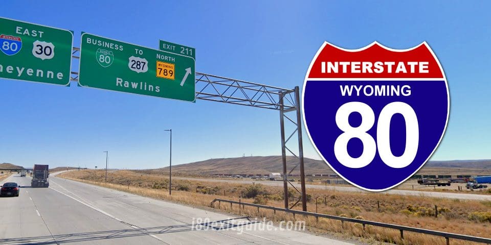
Rawlins offers a welcome shift as you continue westward, serving as a notable gateway to the adventurous landscapes of the southern Rockies. Known for its historic downtown and friendly atmosphere, this city is a practical waypoint for travelers recharging before exploring nearby outdoor destinations. The Carbon County Museum stands out with exhibits on local paleontology, mining history, and the cowboy way of life, enriching your understanding of the region’s heritage.
Rawlins also puts you within striking distance of destinations like the Medicine Bow National Forest and the Seminoe State Park, perfect for hiking, fishing, or simply soaking in dramatic mountain views. By stopping here, you add a layer of outdoor excitement to your I-80 journey that contrasts with the urban amenities you encountered earlier.
The city’s positioning along I-80 means you benefit from a blend of accessibility and authenticity. Modern conveniences like hotels and restaurants merge with a strong sense of community, making Rawlins a reliable and enjoyable stopover that complements the adventurous spirit of Wyoming’s vast landscape.
Navigating the Road: Essential Driving Tips
Driving I-80 through Wyoming means preparing for stretches where services can be sparse, so plan fuel stops carefully to avoid long detours. Maintaining a steady speed around the posted limits, generally 75 mph in rural areas, helps optimize fuel efficiency and safety, especially when heavy trucks share the lanes. Adapting to the flow of traffic while leaving ample space between vehicles mitigates risks from sudden stops or wildlife crossings. Use rest areas strategically—they appear roughly every 30 miles—and take breaks to stay alert during the approximately 400-mile, 6-hour drive across the state.
Wyoming I-80 exit services (food, gas, and lodging) located within 1/2 mile of an I-80 exit are listed here. These listing run east to west. Individual exits show intersecting routes and cities and towns accessible from that exit.
Conditions on I-80 can change quickly, so keeping an eye on your mirrors for changes in traffic patterns is vital. Wyoming’s wide open stretches expose you to crosswinds that may affect your vehicle’s stability; gripping the wheel firmly during gusts keeps the ride smooth. If you’re hauling a trailer or driving heavy, managing your momentum on upgrades and being cautious on downgrades reduces wear on your brakes. This approach maintains control and comfort throughout your journey.
Weather Considerations and Seasonal Challenges

Winter months transform I-80 into a corridor where snow and ice come with added challenges. Wyoming weather averages over 70 inches of snow annually in many segments along the route, with frequent blizzard conditions that reduce visibility to near zero. You’ll find chain-up areas before steep passes such as Sherman Summit, where chains or traction devices are often mandatory during storms. Carrying emergency supplies—like blankets, food, water, and a shovel—is wise since stranded motorists have faced multi-hour delays during heavy snow events.
Planning an I-80 road trip and need to know what the next few days will bring? Here are the latest I-80 weather forecasts for selected cities along the route.
Summer heat brings different hazards along this part of the Interstate. Temperatures can climb above 90°F, which raises pavement temperatures well beyond those figures, risking tire blowouts if inflation isn’t monitored carefully. Thunderstorms, common in late spring and summer, can drop quickly and worsen visibility with sudden downpours. Windstorms also kick up dust in exposed areas, reducing roadside visibility and creating slick pavement from fresh precipitation. This dynamic weather requires a flexible mindset and readiness to adjust your driving strategy promptly.
Safety Protocols and Road Regulations
You’ll encounter explicit signals and signage on I-80 designed to maintain safe driving conditions across varied terrain. Speed limits generally hover between 65-75 mph, but drop into lower limits near urban zones like Cheyenne and Laramie. Enforcement technology including speed cameras and ramp meters helps reduce speeding and accidents. Commercial vehicles face specific rules limiting weight and length, with designated passes at scales to ensure compliance.
What’s happening on Interstate 80 RIGHT NOW! I-80 Real-Time Traffic information for cities along I-80. Maps show updates on road construction, traffic accidents, travel delays and the latest traffic speeds. Traffic cameras show congestion at a glance. DOT posts bring the latest incidents and their status. Road News includes related I-80 articles. Data is automatically updated every 5 minutes, 24 hours a day, 7 days a week!
Seat belts are mandatory for all passengers, with fines applicable on the spot. Wyoming law dictates no cell phone usage while driving unless hands-free, and penalties include fines and possible license points. Stopping on the shoulder is only permitted for emergencies to avoid accidents with passing traffic, and use of hazard lights is required when stopped. This legal framework supports a consistent environment where all drivers know what to expect from one another.
Further compliance includes adherence to chain laws during winter, observable through official signage and updates from the Wyoming Department of Transportation. Staying informed through their real-time traveler information sites before and during your trip allows you to prepare for delays or detours promptly. Understanding these local regulations while adjusting to signage helps create a safe and efficient trip across one of the most scenic yet demanding stretches of I-80.
Wyoming’s I-80 In a Nutshell
From above, driving I-80 in Wyoming offers you an engaging experience through varied landscapes, including expansive plains, rugged mountains, and rich historical landmarks. Spanning approximately 402 miles across the state, this route typically takes around 6 to 7 hours to drive without significant stops. As you travel, you will find well-maintained roadways and numerous rest areas, making your journey comfortable and efficient. Whether you are passing through small towns or taking in scenic views, the route provides a unique insight into Wyoming’s natural beauty and cultural heritage.
By planning your trip along I-80 with consideration for weather and seasonal conditions, you can enhance your safety and enjoyment. Services such as fuel stations and dining options are available at regular intervals, ensuring your needs are met throughout the drive. Ultimately, your journey on I-80 in Wyoming presents an opportunity to appreciate an iconic American highway while connecting easily with major destinations across the region.
The I-80 Exit Guide is the Internet’s largest and most complete website dedicated to Interstate 80 travelers. Find detailed exit service listings… lodging, camping, food, gas and more for every exit from New Jersey to California!
On the road? Why not take us with you. The I-80 Exit Guide is mobile-friendly and totally FREE. No App Required.
Traveling another route? Visit our growing family of exit guides: I-4 Exit Guide, I-5 Exit Guide, I-10 Exit Guide, I-75 Exit Guide, I-80 Exit Guide and I-95 Exit Guide. Detailed exit service listings… discount lodging, camping, food, gas and more for every exit along the way!

